
Sangra De Christo Ranches Unit X-2, Block 263, Lot 5991, San Luis, CO
SOLD - Please check out our other lots!
Lot Information:
Legal Description: Sangra De Christo Ranches Unit X-2, Block 263, Lot 5991, Costilla County, Colorado
27.293 acres Total Lot Acreage,
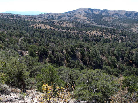
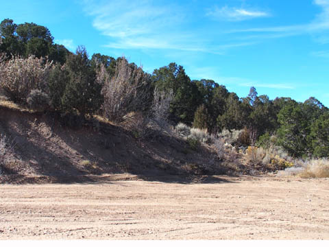
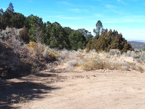
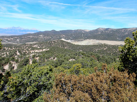
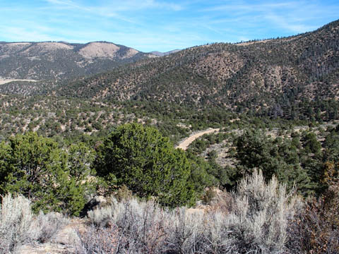
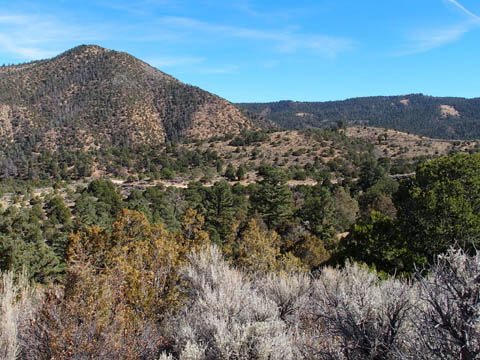
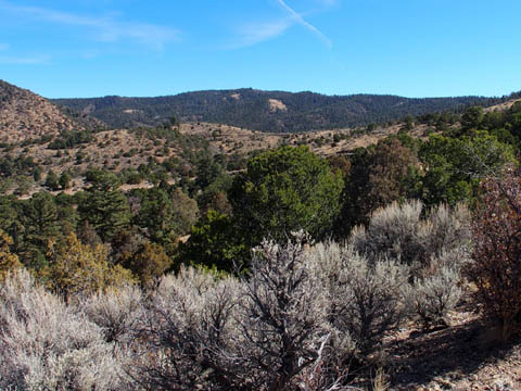
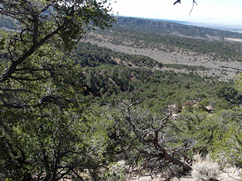
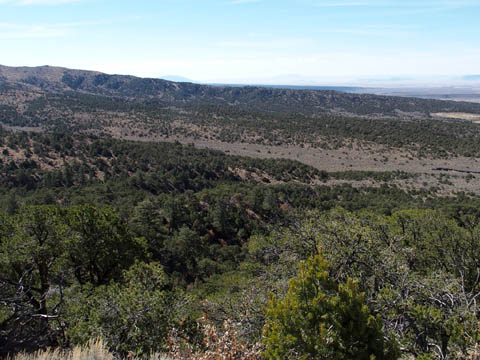
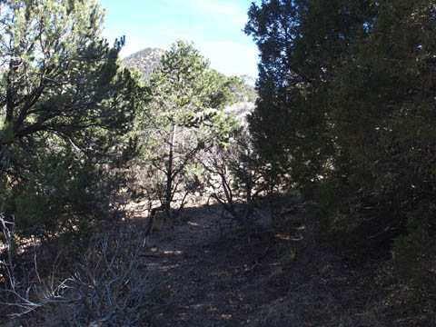
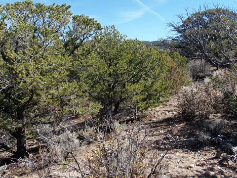
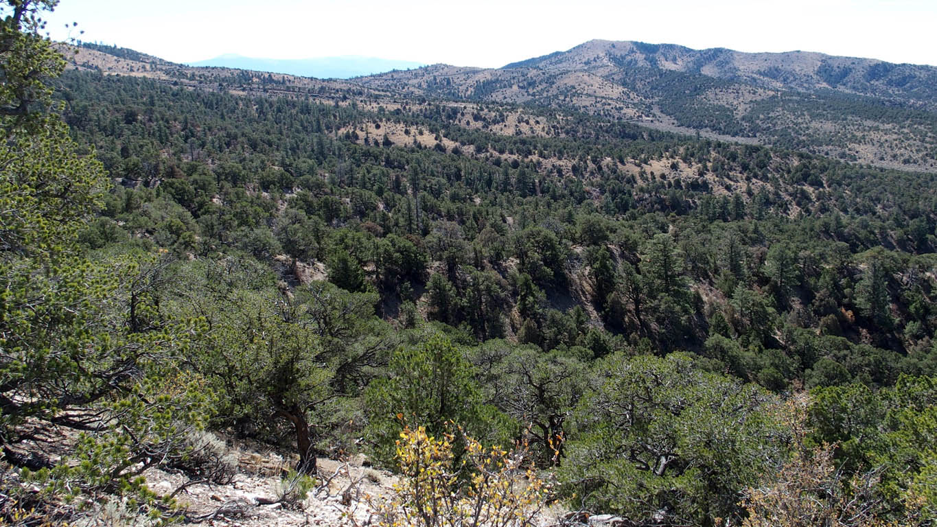
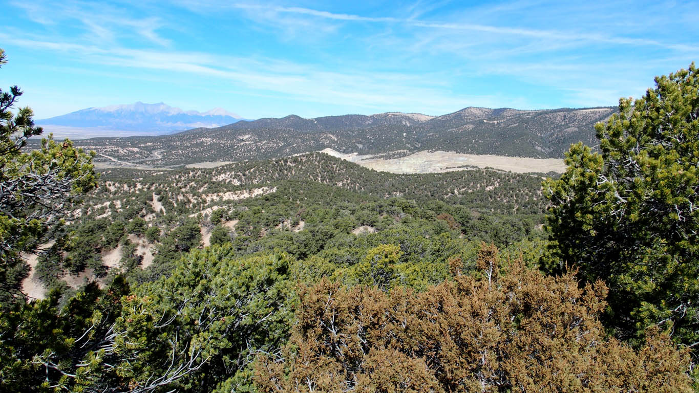
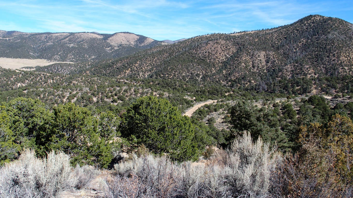
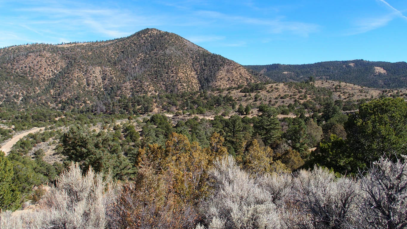
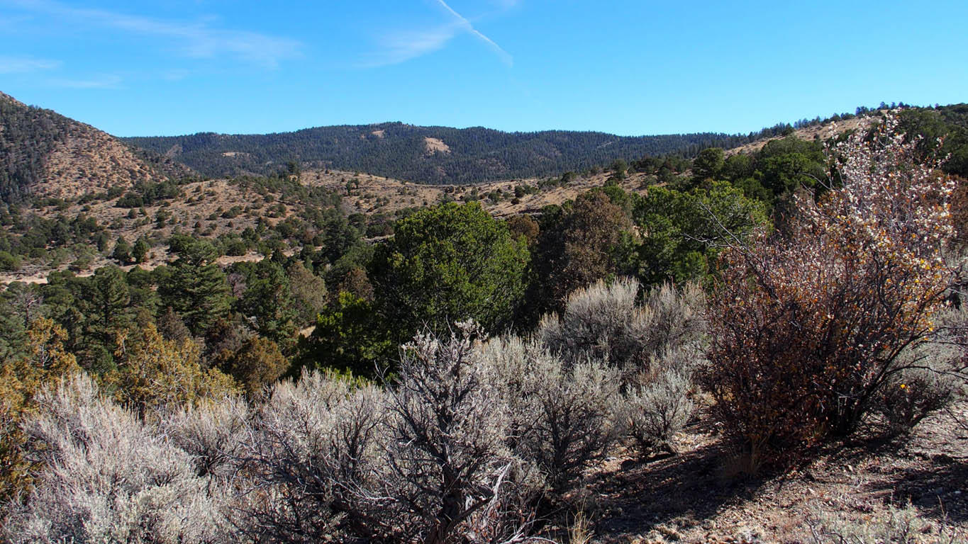
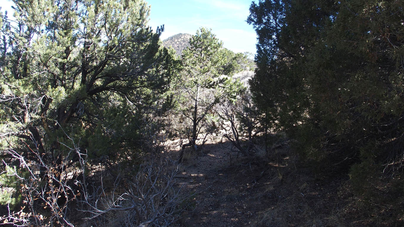
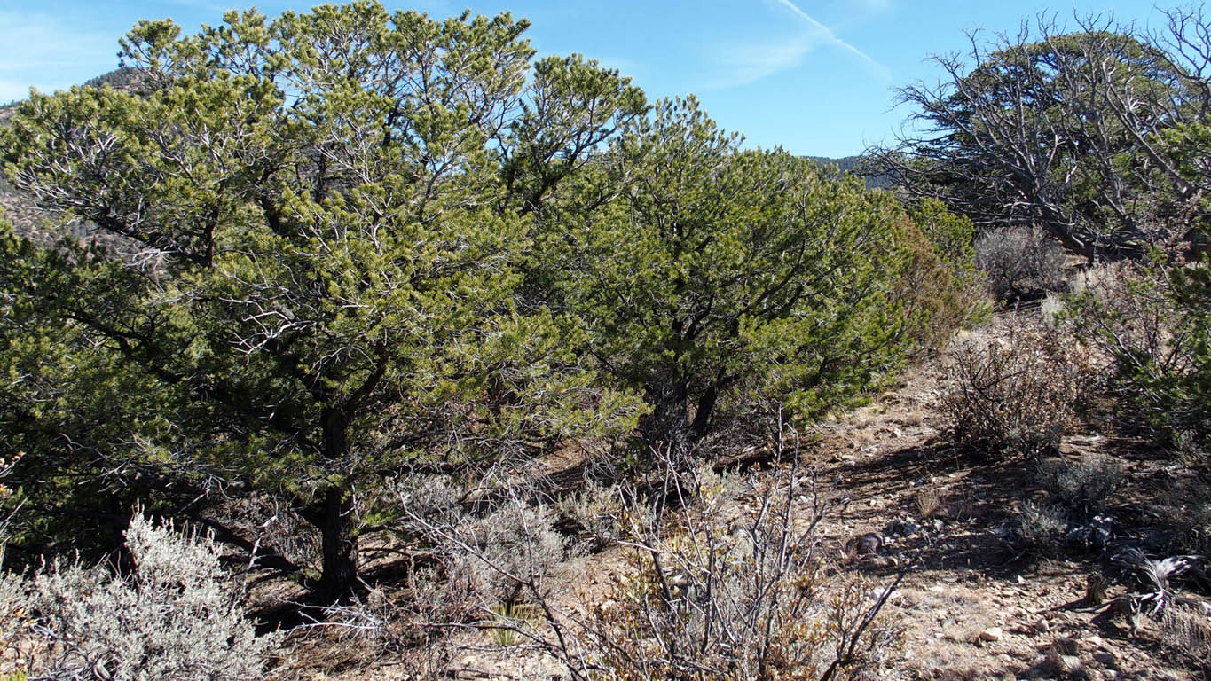
Abundantly treed property,
Mobile homes allowed,
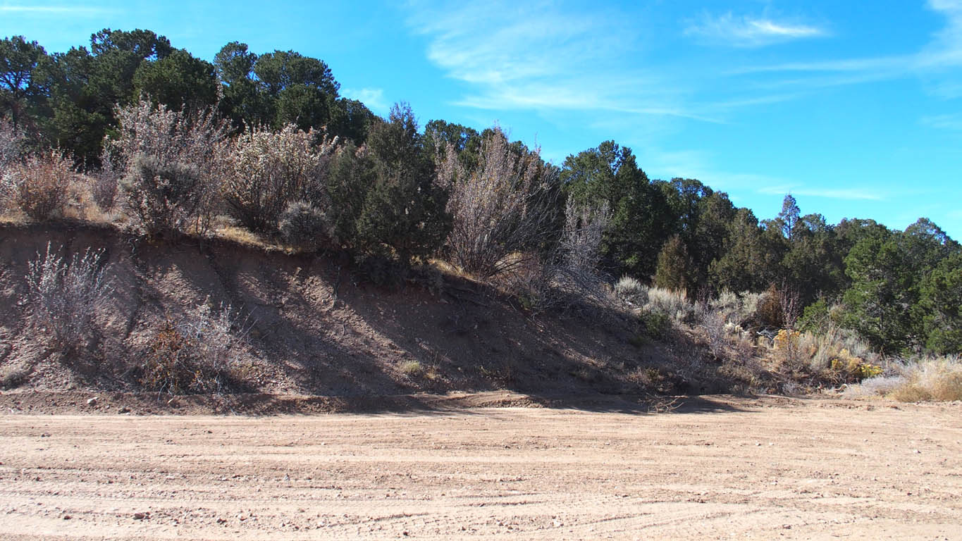
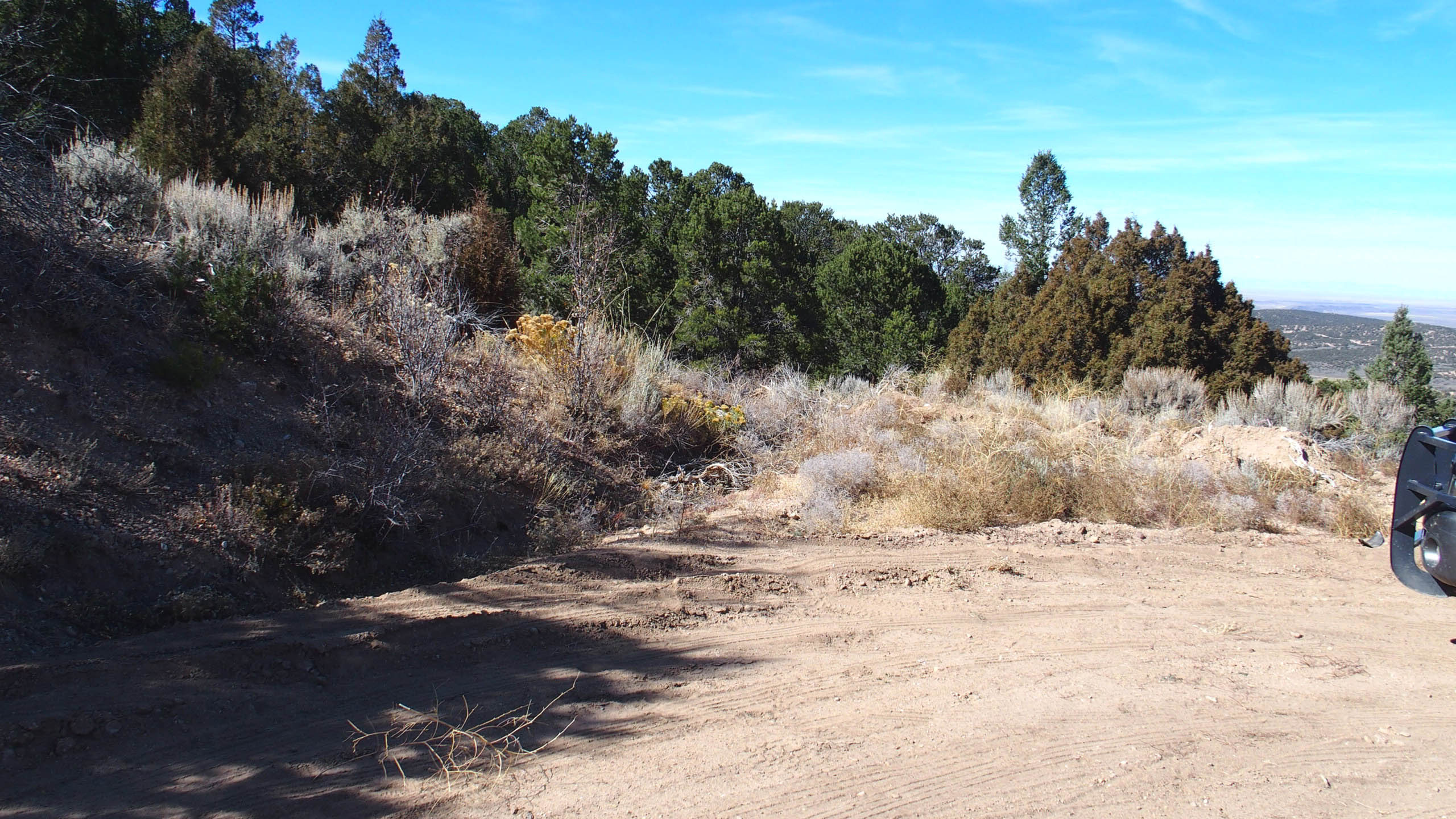
Good road to lot, passible by normal car or RV,
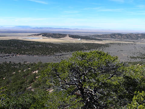
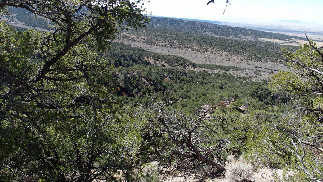
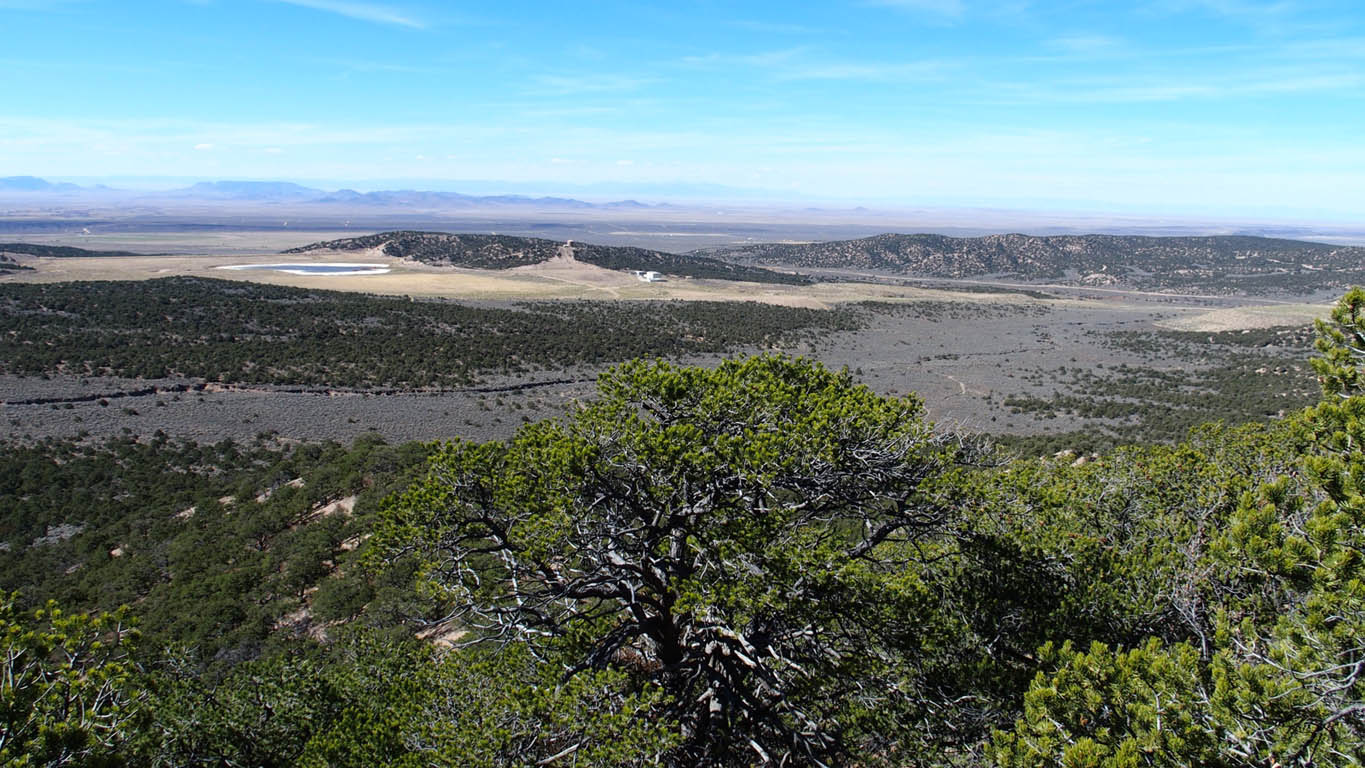
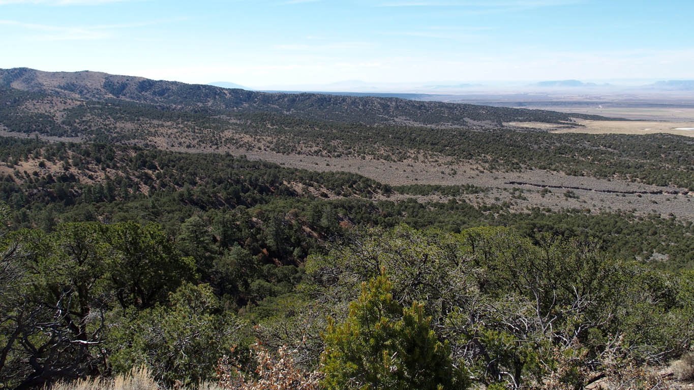
Spectacular 360 degree VIEWS,
Great building site along a point allowing 360 degree views
Close to town for shopping, San Luis, CO is only 11 miles
Discounted cash price: $18,999. Financed price only $21,999 *
* For those persons opting to use owner financing, we do not allow building projects, living on the land, or storing of equipment, supplies, or vehicles. We do allow short-term camping. All county Rules and Regulations must be followed regarding camping and permitting. If you get our permission, you can put in a driveway and/or camping pad, with a permit from the county. There might be a few exceptions, such as keeping a fire-pit on the property which we can allow on an individual basis.
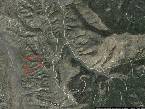
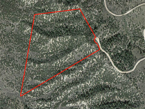
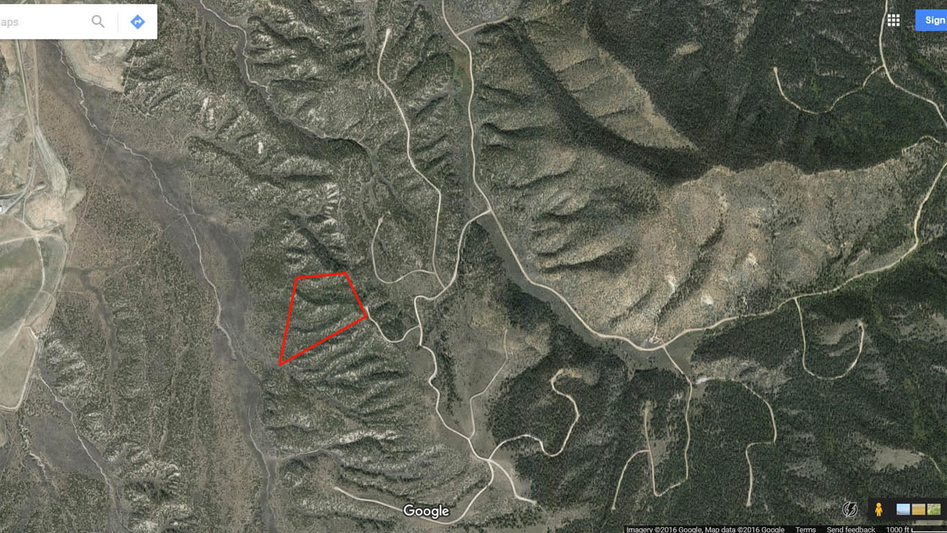
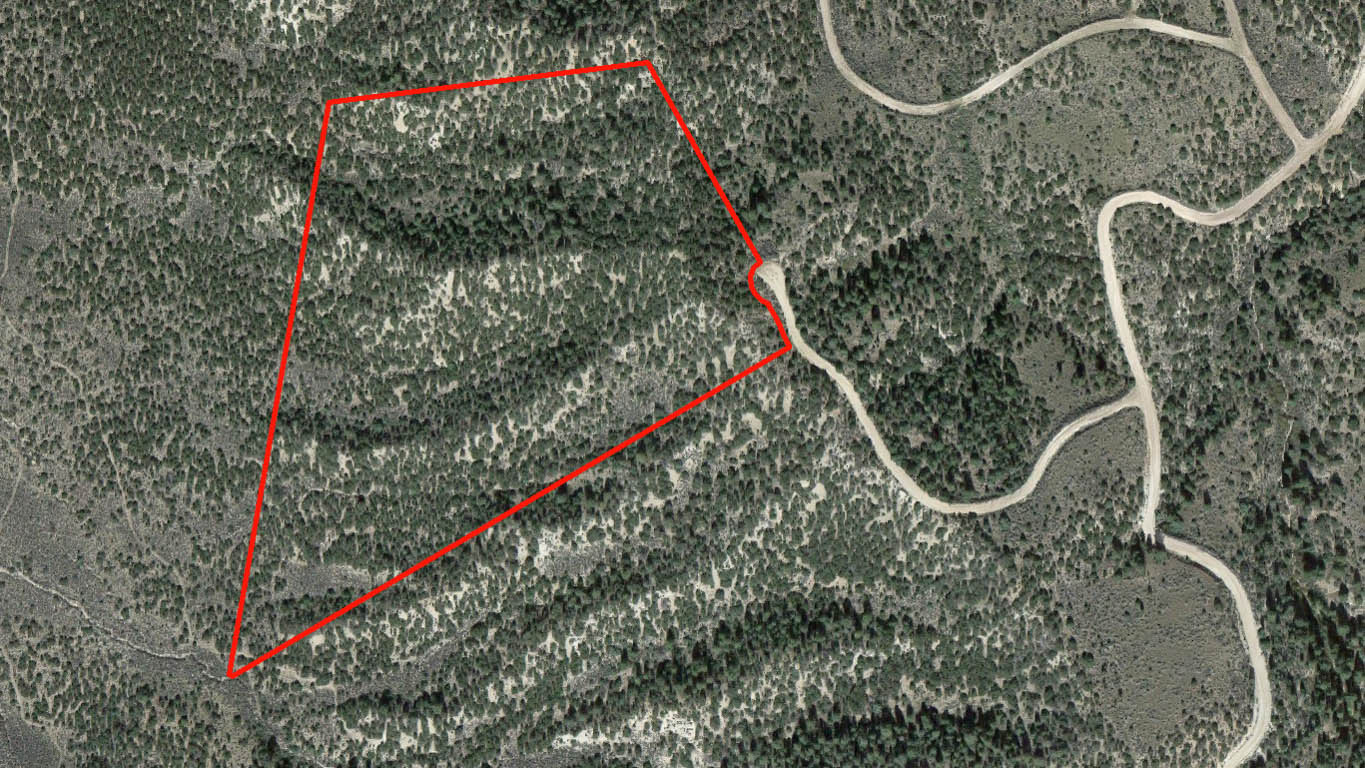
Property Plat Map, highlighted in yellow
Click here for Information about S.D.C.R. Subdivision
Click here for Google Maps showing aerial view of property. Map can be zoomed and scrolled for additional information.
Click here for Bing Maps. Map can be zoomed and scrolled for additional information.
Actual Property Pictures, taken Oct 23, 2016. (Click on images to enlarge).
|
|
||||
|
|
||||
|
|
||||
|
|
||||
|
|
||||
|
|
||||
|
|
Directions: Using "latitude longitude" We were able to use the Maps app on our iPhone to navigate close to the property. The iPhone dropped us on Forbes Rd 1/2 mile before Skidmore Dr. - Destination point, type in: 37.23439 -105.34324
From Fort Garland, CO:
1. From intersection of US-160 head south on CO-159, (12.3 mi)
2. Turn left onto E. Jasper Dr (dirt rd, (0.3 mi)
3. Turn right onto CR-19.5, (0.4 mi)
4. Turn left onto Rito Seco Rd, (5.3 mi)
5. Around the 5.3 mi mark there is a Y, keep right, (305 ft)
6. Turn right onto Forbes Rd (our iPhone dropped us about 3/4 mi later), (1.3 mi)
7. Turn right onto Skidmore Rd., (0.5mi)
--- Now the interesting part ---
8. Supposedly the property is on "Doug Rd", however, the road was labeled as: "Rod Rd" when we were onsite.
-- Whatever the name is when you arrive, it will be the second road on the right. The property is at the end of the cul-de-sac, left of center. We placed orange stakes at the approximate front corners. Use the PLAT OUTLINE (last picture) to figure out approximate boundaries.